

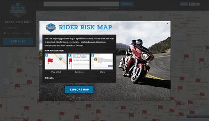
How to Use Allstate's Rider Risk Map

Allstate’s Rider Risk Map on Facebook lets riders share warnings about intersections and stretches of roads that may prove particularly risky. These warnings could be about large potholes, blind corners or other hazards that only those who regularly ride through may know about.
This information would be useful for other riders who are less familiar with the local area and might not be aware of the added risk.
Let’s take a look at how to flag a road and create a warning for other riders (click on the images to enlarge).
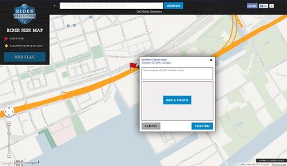
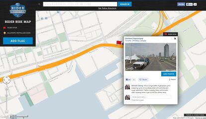
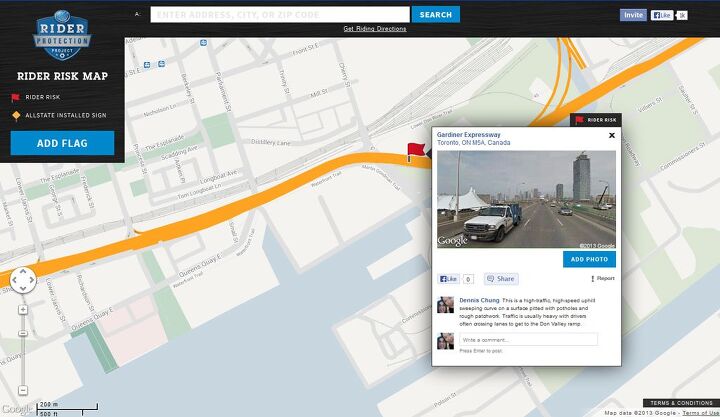
For this example, I selected a section of the Fredrick G. Gardiner Expressway, an elevated freeway in Toronto that runs along the shore of Lake Ontario. There is one particular stretch of the Gardiner I’ve ridden on frequently that can be particularly dangerous for those who haven’t been on it.
It lies on the eastbound lanes between the Lower Jarvis St. on-ramp and the eastern end of the Gardiner where it splits off to a northbound freeway called the Don Valley Parkway and an eastbound street called Lake Shore Blvd. E.
This particular stretch poses several hazards for motorcyclists. The road is a rising S-shaped curve which makes it difficult for riders to see far ahead. The speed limit is 100 kph (about 55 mph), but vehicles typically move at much higher speeds. There is also usually a lot of traffic merging from the Lower Jarvis entrance trying to cross multiple lanes to get to the Don Valley Parkway. To make matters worse, the road surface is pitted with potholes, further increasing the risk for motorcyclists.

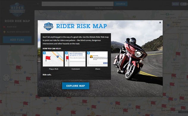
To place a warning flag, I have to first log into Facebook and visit the Rider Risk Map app. The app should ask for your permission to access your Facebook account. You should then see a screen with some more instructions. From here, you should be able to see a map with all the locations flagged by other riders.
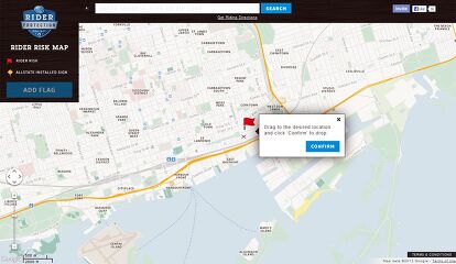
Navigate the map and zoom in to the location you wish to flag and then click on “Add Flag” on the left. A red flag icon should appear. Click and hold your mouse button down on the flag and drag it to the location you want to identify. Click confirm when you are ready.

You should now see a small box asking for details about why that particular stretch of road poses a risk to riders. If you have a picture of that particular location, you may also upload it, otherwise the Rider Risk Map will use one from Google Maps Street View.
Your flag should now appear on the map and anyone else using the Rider Risk Map can click on your flag and read your warning.
Dennis has been a part of the Motorcycle.com team since 2008, and through his tenure, has developed a firm grasp of industry trends, and a solid sense of what's to come. A bloodhound when it comes to tracking information on new motorcycles, if there's a new model on the horizon, you'll probably hear about it from him first.
More by Dennis Chung


Comments
Join the conversation